The 2009 bushfires in January and February ravaged many parts of Victoria and touched directly and indirectly many millions of people in the State, across Australia and internationally.
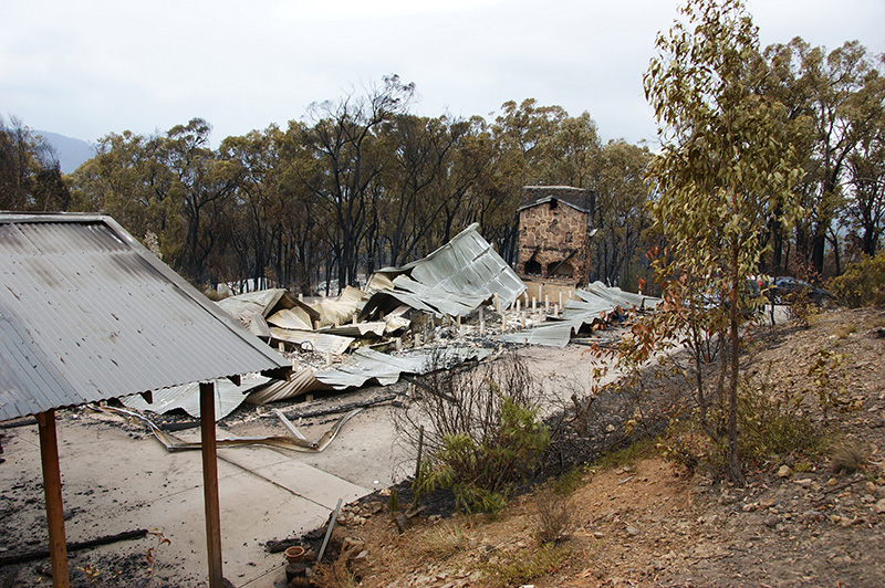
One hundred and seventy three people died, thousands of homes and other dwellings were destroyed and over 400,000 hectares were burnt.
More than 78 communities across Victoria were directly affected.
On 7 February, Black Saturday, Victorian townships including Marysville, Kinglake, Kinglake West, Narbethong, Flowerdale and Strathewen were devastated.
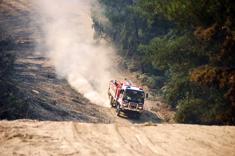
More than 19,000 CFA members were involved in frontline firefighting, incident management and support behind the scenes.
About the fires
In the lead up to Black Saturday, Victoria was hit with a brutal heatwave. Melbourne endured temperatures over 43°C for three consecutive days, exacerbating the already dire effects of a long-term drought. The situation reached critical levels when temperatures soared to 46°C on February 7th, creating extreme fire risk conditions.
Later that day, unpredictable fire paths were caused by wind gusts exceeding 100 km/h, which abruptly changed direction.
The Black Saturday bushfires were unique, due to their swift ignition, the ferocity of their flames, and their tendency to spread in "pulses." These fires could spot up to 35 kilometres ahead of their front, spawning their own weather patterns which triggered storm clouds and lightning strikes, leading to further fires.
Where the fire spread
On the morning of 7 February 2009, powerful winds brought down powerlines in Kilmore East, with sparks igniting a fire.
Between 3.30 pm and 7pm, the fire spread through Kinglake National Park to areas including Strathewen, St Andrews, Kinglake, Kinglake West, Chum Creek, Steels Creek, Arthurs Creek, Flowerdale, Broadford, Healesville, and Toolangi.
At 3pm, the Murrindindi fire started in the Murrindindi State Forest and Black Range, and moved to Narbethong at 4.20pm, Marysville at 6.45pm, and burned through Buxton and Taggerty.
When the fires at Kilmore East and Murrindindi fires merged, they created the most significant fire - the Kinglake Fire Complex. It swept through state forests and national parks, with flames that reached 30 meters in height.
Other fires had started in Bunyip, Horsham, Churchill, Redesdale, Beechworth, Bendigo, Marysville, Narre Warren, and Upper Ferntree Gully.
By evening, almost 400 individual fires were burning across Victoria.
Townships affected by the Black Saturday Fires.
| Location |
Details of fire |
Losses |
|
Kilmore East
|
The fire started at about 11.47am, on top of a rocky hill between two gullies near Saunders Road.
|
- People: 119
- Area (ha): 125,383
- Houses: 1,242
|
|
Horsham (Vectis & Haven)
|
The fire ignited at about 12.20pm; it was a grass fire and in the first hour spread rapidly, covering just over 10 kilometres.
|
- People: 0
- Area (ha): 2,346
- Houses: 13
|
|
Coleraine
|
At about 12.30pm, a fire broke out in a paddock on private farmland about 5 kilometres north-west of the township.
|
- People: 0
- Area (ha): 713
- Houses: 1
|
|
Pomborneit–Weerite
|
The grass fire was relatively short-lived, being active for about five hours on that day but burning over 1,000 hectares. It started at about 1.15pm.
|
- People: 0
- Area (ha): 1008
- Houses: 0
|
|
Churchill
|
The fire started at about 1.32pm, 3 kilometres south-east of the Churchill fire station.
|
- People: 11
- Area (ha): 25,861
- Houses: 145
|
|
Murrindindi
|
The fire started at about 2.55pm, to the north of a sawmill in Wilhelmina Falls Road. It travelled rapidly and by 4.30pm was affecting Narbethong.
|
- People: 40
- Area (ha): 168,542 (Combined area with Kilmore East)
- Houses: 538
|
|
Redesdale
|
The fire was reported at 3.11pm and burned towards the south-east for about 19 kilometres.
|
- People: 0
- Area (ha): 7,086
- Houses: 14
|
|
Narre Warren and Upper Ferntree Gully
|
The fires burned in grass reserves and scrubland, on residential streets, and in homes and gardens.
|
- People: 0
- Area (ha): 163
- Houses: 7
|
|
Bendigo
|
The fire started shortly after 4.00pm in Maiden Gully, 8 kilometres north-west of the central business district.
|
- People: 1
- Area (ha): 341
- Houses: 58
|
|
Beechworth-Mudgegonga
|
Fire in the area began at about 6.00pm and burned fiercely until weather conditions moderated in the early hours of 8 February.
|
- People: 2
- Area (ha) 33,577:
- Houses: 38
|
The aftermath
The Black Saturday bushfires claimed the lives of 173 people, 120 in the Kinglake area alone.
Another 414 people were injured. More than 450,000 hectares had burned and 3,500 buildings including more than 2,000 houses, were destroyed. Up to one million wild and domesticated animals died in the disaster (RSCPA estimate).
The Victorian Premier, John Brumby announced a royal commission into the fires on 13 February 2009. The Commission conducted an extensive investigation into the causes of, the preparation for, the response to and the impact of the fires.
It contained 67 recommendations, many of which prompted changes in CFA’s bushfire education policies and the ways we work together with other state fire authorities. You can view the 2009 Victorian Bushfires Royal Commission final report.
Our volunteers
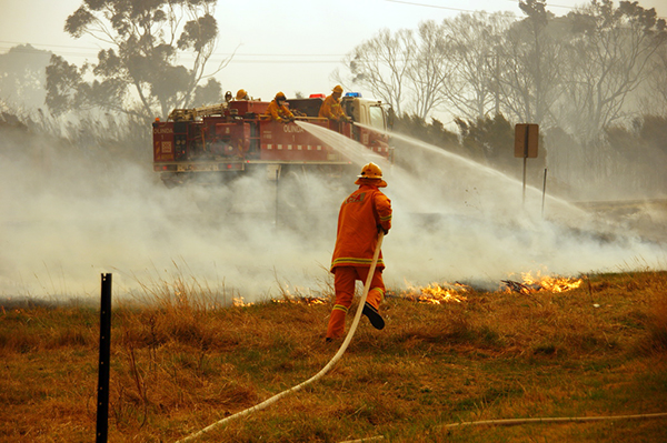
Over 19,000 brave CFA volunteers and staff were involved in the efforts to contain and manage the history-making fire events of February 2009.
The community looked to our members for help, and CFA volunteers were battling on the frontline with some also providing leadership and comfort to those impacted.
Tragically, CFA lost one of its own during these fires. Arthurs Creek CFA volunteer firefighter Joe Shepherd died in Melbourne’s Alfred Hospital on 22 February as a result of the severe injuries he received on Black Saturday.
ACT firefighter David Balfour also died tragically while assisting Victoria’s emergency services in the February firefight.
We will forever recognise and remember the lives of Joe and David.
Maps of the 2009 Bushfires
Major bushfires occured in late January 2009 and continued until March 2009. Listed below are high and low resolution maps of those major fires.
Page last updated: Wednesday, 20 September 2023 4:05:41 PM